Etomesto
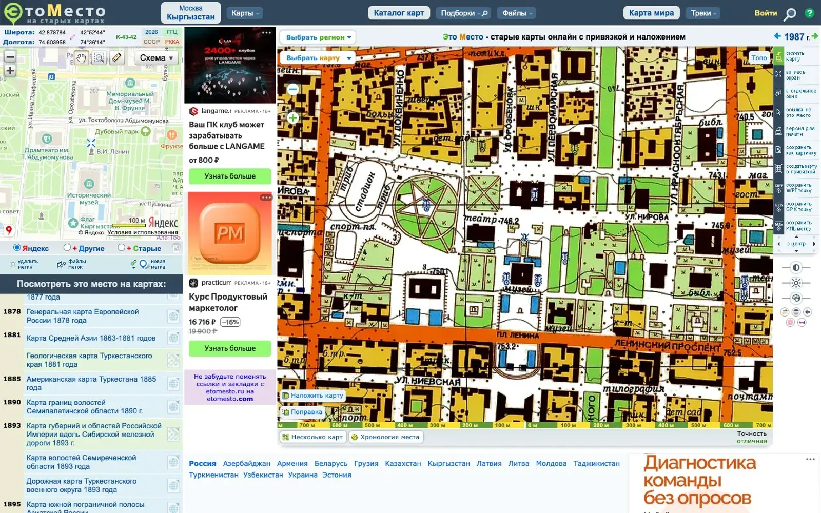
Old maps of cities and regions georeferenced against a modern map: lay an 18th–20th century plan over today's streets and see what stood where you live.
What it is
Etomesto ("This Place") is a Russian-language site full of old maps pinned to real coordinates. Open, say, a late 18th-century plan of a town or district and it's linked to a modern map in a window alongside, so matching old streets to today's is easy. Russia has the biggest coverage, but there are also maps of other former Soviet countries, from Belarus and Georgia to Kazakhstan and Kyrgyzstan. The site recently moved from etomesto.ru to etomesto.com.
Why we picked it
It's one of the most direct ways to feel the history of a place. Where a village stood before only its name survived, how an old road ran, what a street looked like before it was renamed — a couple of clicks and you see it. The collection is huge: 18th-century land surveys, Schubert's three-verst military maps, Mende's maps, Red Army topographic sheets, German and American maps, 1940s aerial photography and Soviet-era tourist maps. You can drop your own markers, draw a route, upload a GPS track and download maps for navigation apps to walk the old road for real. The interface is old-fashioned, but it works, and new maps keep being added.
Where to start
- Pick a city or region and open the oldest plan available.
- Expand the modern-map window and look for a building you know on the old plan.
- Browse the city plans section — it's the prettiest part of the site.
- If you hike, upload a track and compare it with a century-old map.
Who it's for
Local historians, people tracing family villages, hikers, and geography or history teachers. The interface is in Russian, but maps are visual, so a browser translator gets you most of the way.
Quick answers
Which countries are covered? Mostly Russia, plus other former Soviet countries including Kyrgyzstan and Kazakhstan.
Is it free? Viewing maps online is free; some rare maps are marked as paid.
Can I use the maps outdoors? Yes, the site offers files for navigation apps such as OziExplorer, Locus Map and AlpineQuest.