Itiner-e: every road in Rome's empire
The most detailed open atlas of Roman roads: an interactive map of the whole empire where you can plot a route like an ancient traveler. A research project that's free to explore.
What it is
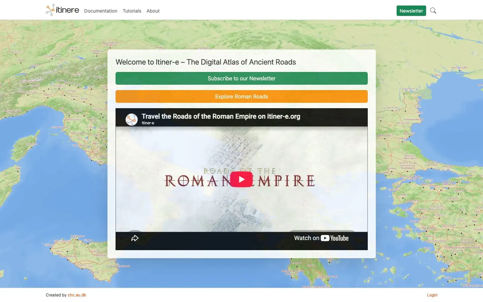
Itiner-e is a digital atlas of ancient roads, above all the roads of the Roman Empire. Its makers call it the most detailed open dataset of Roman roads there is. The project is co-directed by three researchers, Tom Brughmans, Pau de Soto Cañamares and Adam Pažout, with development by Aarhus University's Centre for Humanities Computing.
Why we picked it
Everyone has heard that all roads lead to Rome, but you rarely get to see those roads all at once. Here the whole network sits on one map, from Britain to the Near East, and you can pore over it as long as you like: where roads bunch up, where they stop, how they bend around mountains. Each stretch of road is its own record with its own page and sources, so this isn't an illustration, it's a working research tool you're allowed to play with.
The best part is the route finder. Pick two points and see how a traveler of the time would have made the trip. Distances you read about in ancient texts start to feel very different after that.
The project was written up in the journal Scientific Data in 2025, and the data is released under a CC BY 4.0 license with downloads available, which is generous for an academic project.
Where to start
- Open the map and zoom into a region you know: Italy, Spain or the Balkans.
- Click any road segment to open its record and sources.
- Try the route finder between two ancient cities.
- Browse the tutorials to learn what the map can do.
- If you work with data, grab the open dataset.
Who it's for
Anyone into ancient history, travelers heading around the Mediterranean, history and archaeology students, and people who just love a beautiful map.
Quick answers
Who's behind it? Co-directors Tom Brughmans, Pau de Soto Cañamares and Adam Pažout, with development at Aarhus University.
Can I reuse the data? Yes. It's published under CC BY 4.0 and can be downloaded.
Is it only Roman roads? Roman roads are the core of the atlas, which describes itself as a digital atlas of ancient roads.