Ancient Earth globe
A 3D globe of Earth across 750 million years. Pick an era to see the continents drift, or type in your town to see where it sat in the age of dinosaurs.
What it is
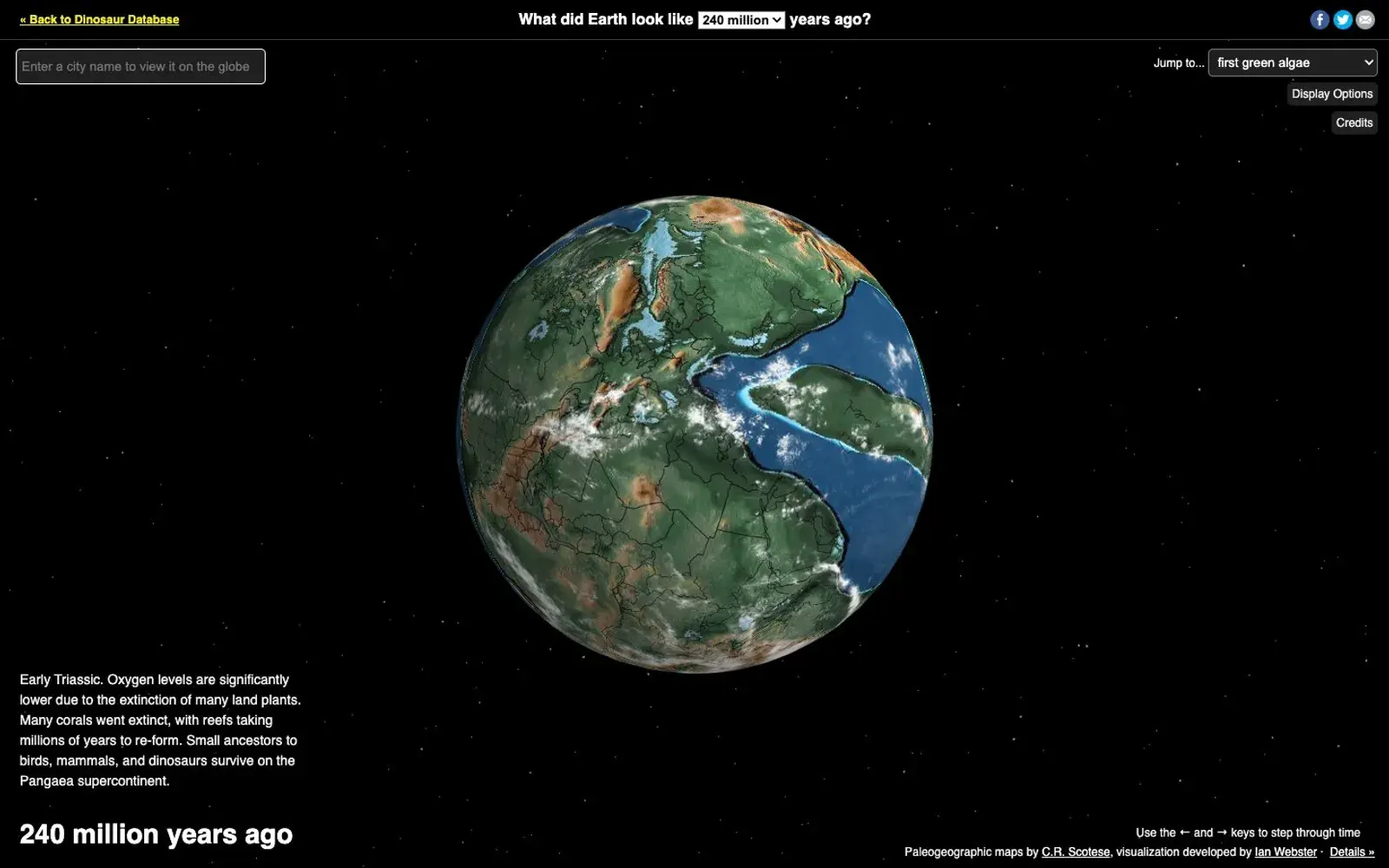
An interactive globe that shows what Earth looked like at different points over the past 750 million years. Pick an era from the "Jump to…" menu and watch the continents drift apart, crash together into Pangaea and sink beneath shallow seas. You can spin the globe freely, and the colours show ocean depth and land elevation. It's built and maintained by developer Ian Webster as part of dinosaurpictures.org, using plate tectonic and paleogeographic maps from geologist Christopher Scotese's PALEOMAP Project.
Why we picked it
Most of us remember the word "Pangaea" from school but have no real sense of what it meant for any particular place. Here you can type in an address and a pin appears on the ancient globe, showing where that patch of land sat 200, 100 or 66 million years ago. Your hometown might turn out to have been on the floor of a warm sea or in the middle of a supercontinent. The credits are refreshingly honest about limits: locations are accurate to roughly 100 km, and clouds and stars aren't adjusted for the era.
Where to start
- Type your town into the address box and step through the eras.
- Jump to the age of the dinosaurs and compare it with today.
- Open "Display Options" to toggle layers on and off.
- Try the earliest dates, when Earth is barely recognisable.
- Head back to the main dinosaur database to see what lived in the period you picked.
Who it's for
Dinosaur-obsessed kids and the adults who get dragged into it. Geography and biology teachers who want a quick, visual hook. Anyone who finds deep time slightly dizzying and enjoys that feeling. It's also a great conversation starter: where was our house when T. rex was around?
Quick answers
Where does the data come from? The maps come from the PALEOMAP Project by C. R. Scotese, credited on the page.
How accurate is the location of my town? The author says locations are accurate to about 100 km.
Is it free? Yes. There's an optional Substack newsletter for updates on new dinosaur and tectonic data.