Topotijdreis: 200 years of Dutch maps
A map of the Netherlands with a year slider, from Napoleonic-era surveys in 1815 to aerial photos of the 2020s. Watch sea turn into polder and villages into cities.
What it is
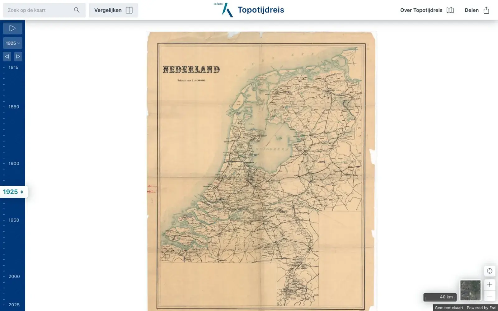
Topotijdreis — roughly "topo time travel" — is a map of the Netherlands with a slider that runs from 1815 to the present. It comes from the Kadaster, the Dutch land registry and mapping agency, which traces its roots to the Topographical Bureau founded on 18 February 1815; the app launched in 2015 for the bureau's 200th birthday. All the major series are layered in: a Napoleonic-era postal route map, the Krayenhoff map, the rare Tranchot map of the land between the Meuse and the Rhine, the 19th-century military topographic map, color "Bonne sheets" from 1865, and today's TOP25 and TOP50. Aerial photos are added from 2006 onward.
Why we picked it
The Netherlands is a country that was literally redrawn, and here you can watch it happen. Park the map over Flevoland, drag the slider, and open water turns into land crossed by ruler-straight roads. Amsterdam spreads out ring by ring, villages merge into suburbs, rivers get straightened. There's a side-by-side compare mode and a play button that runs the years for you. The FAQ even explains why airfields and barracks are missing from older sheets: they were left blank or covered with invented meadows and ditches.
Where to start
- Search for Flevoland or Schiphol and scrub from 1900 to 1970.
- Turn on "Vergelijken" (compare) and put 1850 next to 2025.
- Hit play over Rotterdam and watch the port grow.
- Zoom into a village in southern Limburg at 1815 — that's the Tranchot map.
- Switch to aerial photos and compare with the map from the same year.
Who it's for
Map lovers, history fans, anyone studying or visiting the Netherlands, and anyone who enjoys watching landscapes change. The interface is in Dutch only, but there are just a few buttons and the map speaks for itself.
Quick answers
What years does it cover? 1815 to today; aerial photos from 2006.
Can I download the maps? No — viewing only; printed maps can be ordered from the Kadaster.
Anything before 1815? No, there was no national topographic service yet.