OldNYC
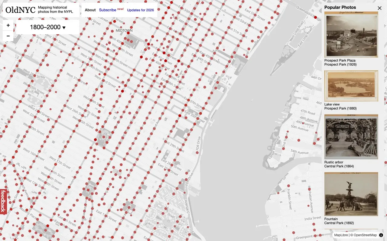
A map of New York covered in dots, each one opening historical photos of that exact spot from the New York Public Library's collection.
What it is
OldNYC is a map of New York with thousands of dots on it. Click one and you get the old photographs taken at that spot, along with their captions. The pictures come from the New York Public Library's Photographic Views of New York City, 1870s–1970s collection, which holds more than 80,000 original prints. Most of them are the work of Percy Loomis Sperr, who spent the late 1920s to the early 1940s documenting how the city was changing.
Software engineer Dan Vanderkam built it with a couple of friends and help from NYPL Labs. He'd already made OldSF from San Francisco Public Library photos, moved to New York, and decided his new home deserved the same treatment.
Why we picked it
In the library's own catalog these photos are filed by the address typed on the back, which makes it hard to find your corner. OldNYC geocoded the images, cut individual photos out of scans that held several, and ran OCR on the typewritten captions on the reverse. The result feels like Street View with a time dial.
The intro picks make the point straight away: a country house in Queens in 1922, on land that's now JFK airport; Broadway at 34th Street in 1901 with a muddy, unpaved road; a Coney Island beach scene from 1939. You can narrow the photos to a range of years, flip through a slideshow for a location, and copy a link to any single shot.
It's still looked after. The project's GitHub repository has commits from 2026 improving how photos get placed on the map, and visitors pitch in by leaving comments on what's there now, fixing transcribed captions, and flagging images that are rotated.
Where to start
- Zoom into a neighborhood you know, even if only from films, and click around.
- Set the year filter to a single decade, say the 1930s, and watch which dots stay.
- Open a photo and read the caption from the back of the print; it often gives the address, date and what was being recorded.
- Pull up the same intersection in any modern map and compare.
- Spot a mistake in a caption? Use "Improve this transcription."
Who it's for
Anyone who loves New York or is planning a trip, people into urban history and architecture, photographers curious about early 20th-century street photography, and history teachers who want something more vivid than a textbook.
Quick answers
Is it free? Yes, you can browse the map and photos without an account.
Can I reuse the photos? The library keeps the copyright on many of them; its terms and conditions explain what's allowed.
Is there one for other cities? The same author made OldSF, and the code is open source, so others have built similar maps for their own towns.